
Schedule & Field Trips
Activity Schedule
The preliminary schedule for the 2026 Camp - the exact timing of events may change.
| Date | Activity |
|---|---|
| May 11 | Move-in Day/ No official activity |
| May 12 | Introduction to Field Sites and Objectives |
| May 13-15 | Week 1 Activities |
| May 16-17 | Off |
| May 18 | Week 1 Activities (cont) |
| May 19 | Week 1 Synthesis Day |
| May 20-22 | Week 2 Activities |
| May 23-24 | Off |
| May 25 | Week 2 Activities (cont) |
| May 26 | Week 2 Synthesis Day |
| May 27-30 | TN/KY Field Trip |
| May 31 - June 1 | Off |
| June 2-5 | Week 3 Activities |
| June 6-7 | Off |
| June 8 | Week 3 Synthesis Day |
| June 9-12 | Week 4 Activities |
| June 13-14 | Off |
| June 15 | Week 4 Synthesis Day |
| June 16-17 | Field Trip |
| June 18-19 | River Trip |
| June 20 | Camp Over |
Field Trips
Along with the field activities, we intersperse several day-long field trips to locations in the Blue Ridge physiographic province, the Great Smoky Mountain National Park, and Mammoth Cave National Park. The intent of the field trips is to examine the geologic features that comprise the bedrock and to gain insights into some of the geologic controls on the hydrogeologic framework.
The exact sites vary each year, but we typically visit the following:
-
- Whiteside Mountain, North Carolina
- University of Tennessee
- Woodall Shoal, South Carolina
- White Oak Sinks and Cades Cove, Great Smoky Mountain National Park
- Historic Tour (caving tour), Mammoth Cave National Park
- Pennyroyal Plateau (karst), Kentucky
- Chattooga River (river trip), South Carolina
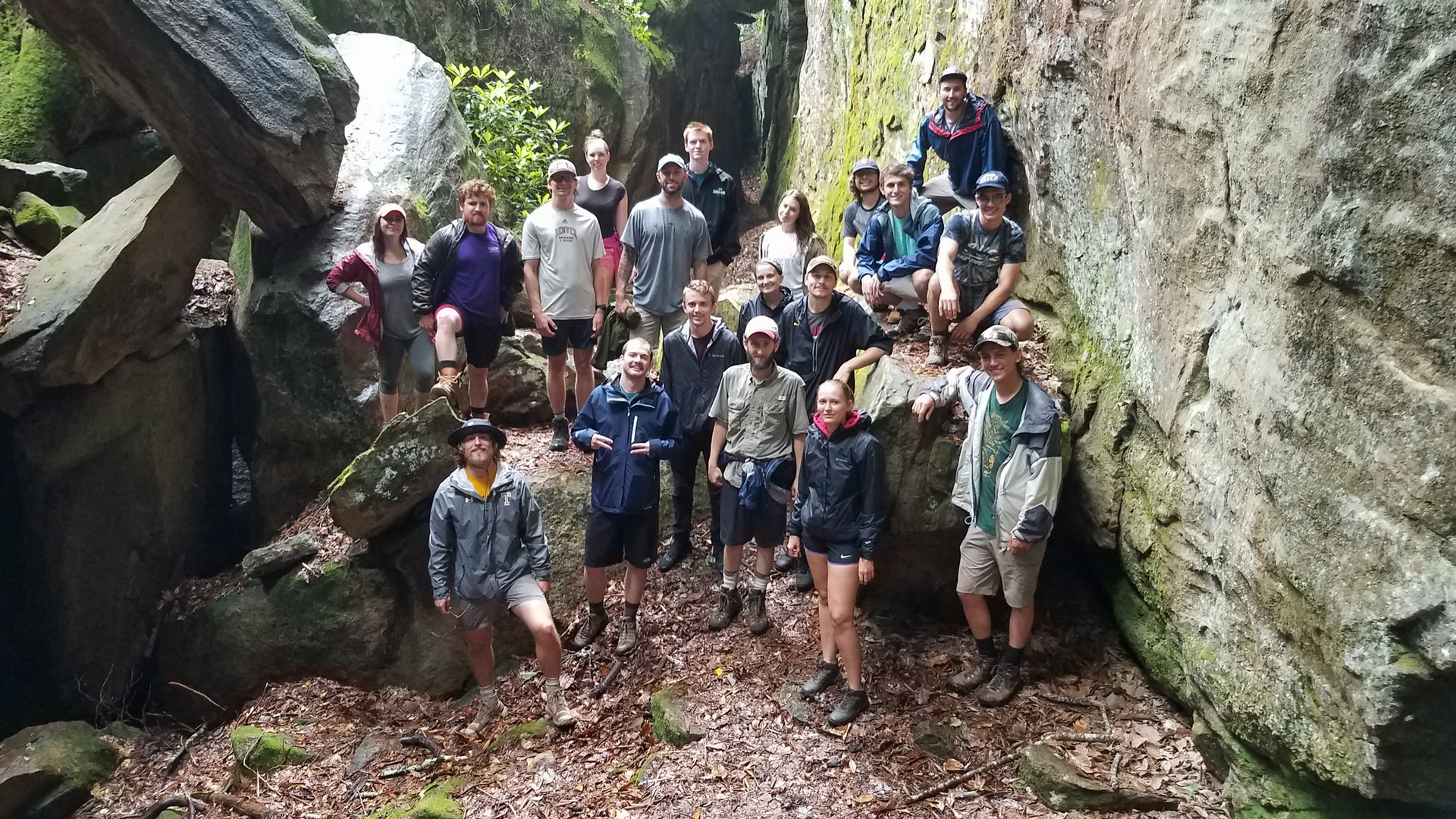
Large joint in Whiteside trondhjemite at Granite City
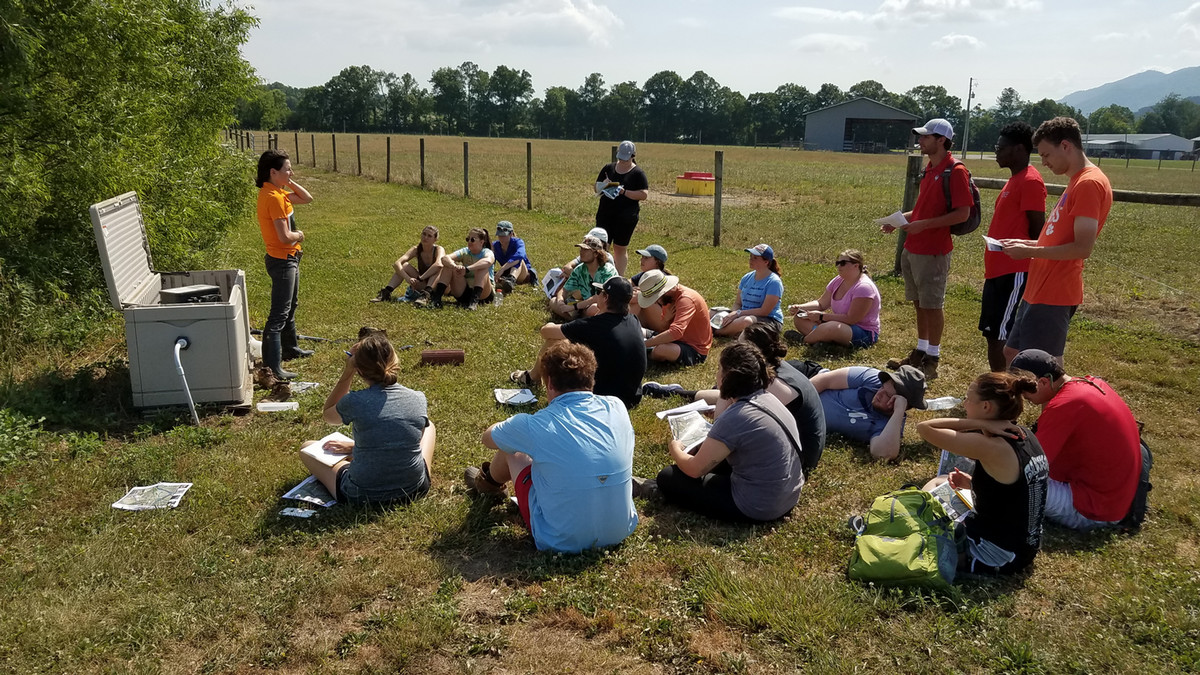
Wetland treatment system at the UT dairy farm
Settings - Piedmont physiographic province
The home base for most of our field exercises is the campus and university-owned land held by Clemson University. We are located in the Piedmont physiographic province, and the rocks are primarily metamorphic with igneous intrusions. This geologic setting results in a fractured, crystalline-bedrock hydrogeologic framework (Figure 1). We have two wellfields situated in this framework: one immediately adjacent to a prominent creek and the other situated on a groundwater divide. The wellfield next to the creek has six wells with one screened in the saprolite and the other five completed as open hole to a depth of 200'. An open hole completion means that the well is cased (sealed) down to bedrock and then open to the bottom (no casing or screens). The upper wellfield has three wells, with one completed in the saprolite and the other two are open hole completions.
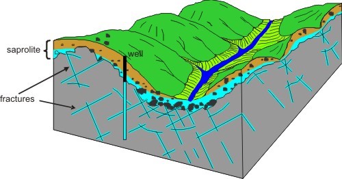
Figure 1. A generalized rendition of a fractured bedrock aquifer. Modified from Heath, Ralph C., 1984, Groundwater regions of the United States, USGS WSP 2242.
We also maintain a wellfield in a shallow (30'-40') deep alluvial aquifer at which we conduct permeable media aquifer tests. These unconsolidated sediments overlie the crystalline bedrock. This wellfield is immediately adjacent to campus and is in the floodplain of the Seneca River. The shallow depth of the aquifer allows us to install monitoring wells with our departmental Geoprobe and by hand. We have six wells screened in the sediments with a drilling rig, and numerous wells installed with our Geoprobe.
We spend a week away from the Clemson area in Tennessee and Kentucky examining sedimentary aquifer systems. We use the University of Tennessee's wellfield to conduct aquifer tests in a shallow alluvial aquifer underlain by tilted rocks of the Valley and Ridge physiographic province (Figure 2). The UT field site has approximately 40 feet of alluvium overlying fractured shale bedrock. There are twelve wells at the site, with three screened in the surficial silts, five screened in a semi-confined sand aquifer, one in a basal clay layer, and three in the bedrock.
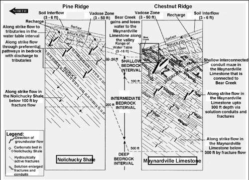
Figure 2. Hydrogeologic regime of the Valley and Ridge
We examine surface and subsurface karst features in and around Mammoth Cave National Park, Kentucky, that control the flow in and out of the cave systems underlying the area (Figure 3). Students are exposed to the complexities and challenges of characterizing a karst system.
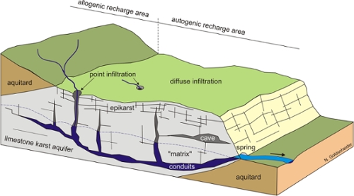
Figure 3. Karst aquifer showing groundwater recharge and discharge (used with permission; from Goldscheider, Nico, and Drew, David, 2007, Methods in Karst Hydrogeology, in International Contributions to Hydrogeology 26, Taylor and Francis, London, UK)