

3D Scanning and Analysis
3D scanning is the technique used to virtually collect geometric features of a physical object using non-contact measurement. The WLCC team has developed capabilities in three dimensional scanning documentation and analysis of an array of objects using structured light scanning, laser scanning and stereo photogrammetry. The team at the WLCC is utilizing this state of the art technology as part of the process to document, conserve, and study not only heritage objects and sites, but other fields and disciplines utilizing 3d scanning, such as; automotive and aerospace engineering.
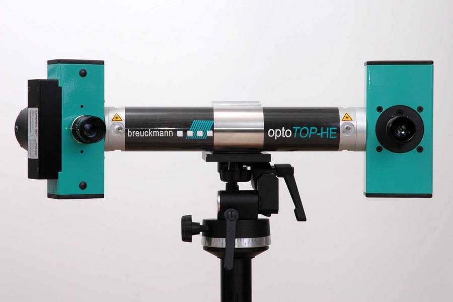
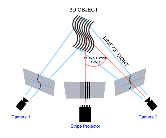
The primary instrument in our toolbox is the Breuckmann OptoTOP-HE scanner (as seen above). This device uses structured-light scanning technology which is designed for surface scanning and 3D topography, recording the texture, color, and dimension of the object. Two cameras positioned like eyes give the machine binocular disparity creating depth perception. It offers highly accurate measurements of surfaces, designed for documentation, study, analysis and reconstruction of an object or a site.
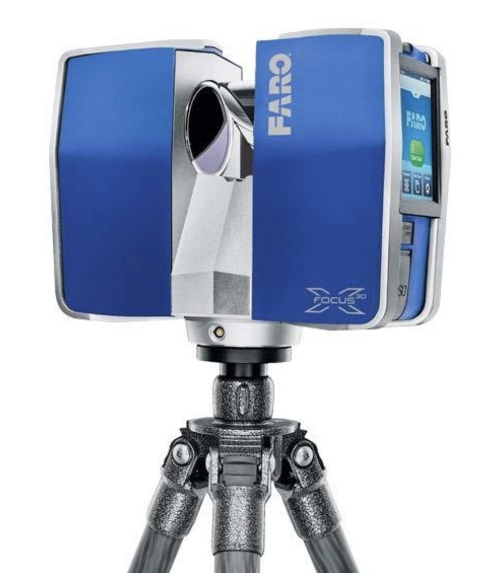
The laboratory is also equipped with a Faro Focus3D X 330 focus 3D laser scanner designed for both interior and exterior documentation of scenes and architecture with a high level of precision. The system can collect 3D point-cloud data in a 360-degree area around the device with a speed of up to 976,000 pts/sec at a range of up to 330 m.
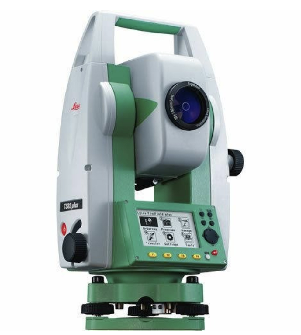
The Leica TS02 Plus Total Station uses a reflector-less laser to record point, distance, and angle measurements up to a range of 1640 feet.
The process that the virtual reconstruction/metrology team at WLCC uses is broken into 3 categories:
3D Scanning: Capturing 3D data from an existing object using a white light scanner (Close Range Scanning, Large/Small Object Scanning)
Digital Modeling: Replicate and computerize physical objects (Polygonal Models, NURBS, all files can be exported to suit the end users 3D visualization platform)
Inspection/Analysis: Using advanced measurement techniques, scanned objects can be analyzed in a number of ways (3D Scan to Original Model Inspection, Scanned/Digitized Object to 2D Drawing, or Scanned/Digitized Object to Scanned/Digitized Object)
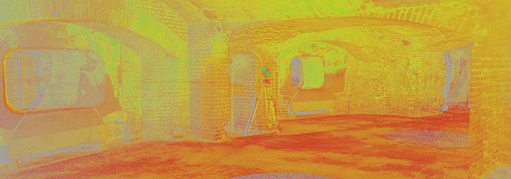 Collecting laser scan data at Fort Sumter using the Trimble GX Scanner. The project was completed in partnership with NPS and the Clemson University Department of Civil Engineering.
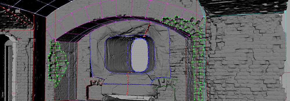 Reconstruction phase of the structured analysis project. Key points are harvested from the 3d data to determine possible areas of damage.
 3d comparison of pre and post conservation corks from the 1565 wreck San Juan discovered in Red Bay, Labrador, Canada. Using PolyWorks the shape deformation can be determined and used to advise Parks Canada in the conservation process.
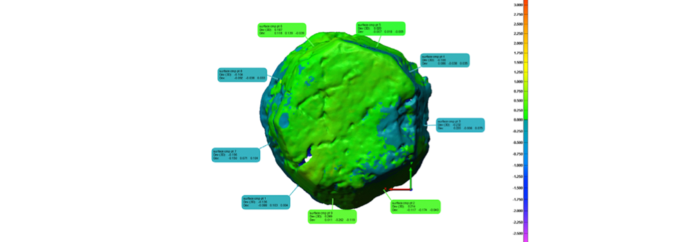 3d comparison of pre and post conservation corks from the 1565 wreck San Juan discovered in Red Bay, Labrador, Canada. Using PolyWorks the shape deformation can be determined and used to advise Parks Canada in the conservation process.