Project History and Ground Penetrating Radar
The Work of Carrel Cowan-Ricks
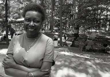
Carrel Cowan-Ricks was a trailblazing African American archaeologist who conducted extensive research on African American culture and traditions through historical archaeology at Clemson University. From 1991-1993, she searched for the graves of enslaved people who died at Fort Hill Plantation and convicted laborers who died while building Clemson College. At the time, she was one of only a few Black female archaeologists in the United States.

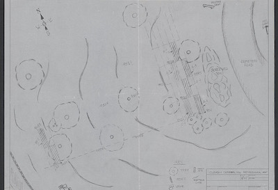
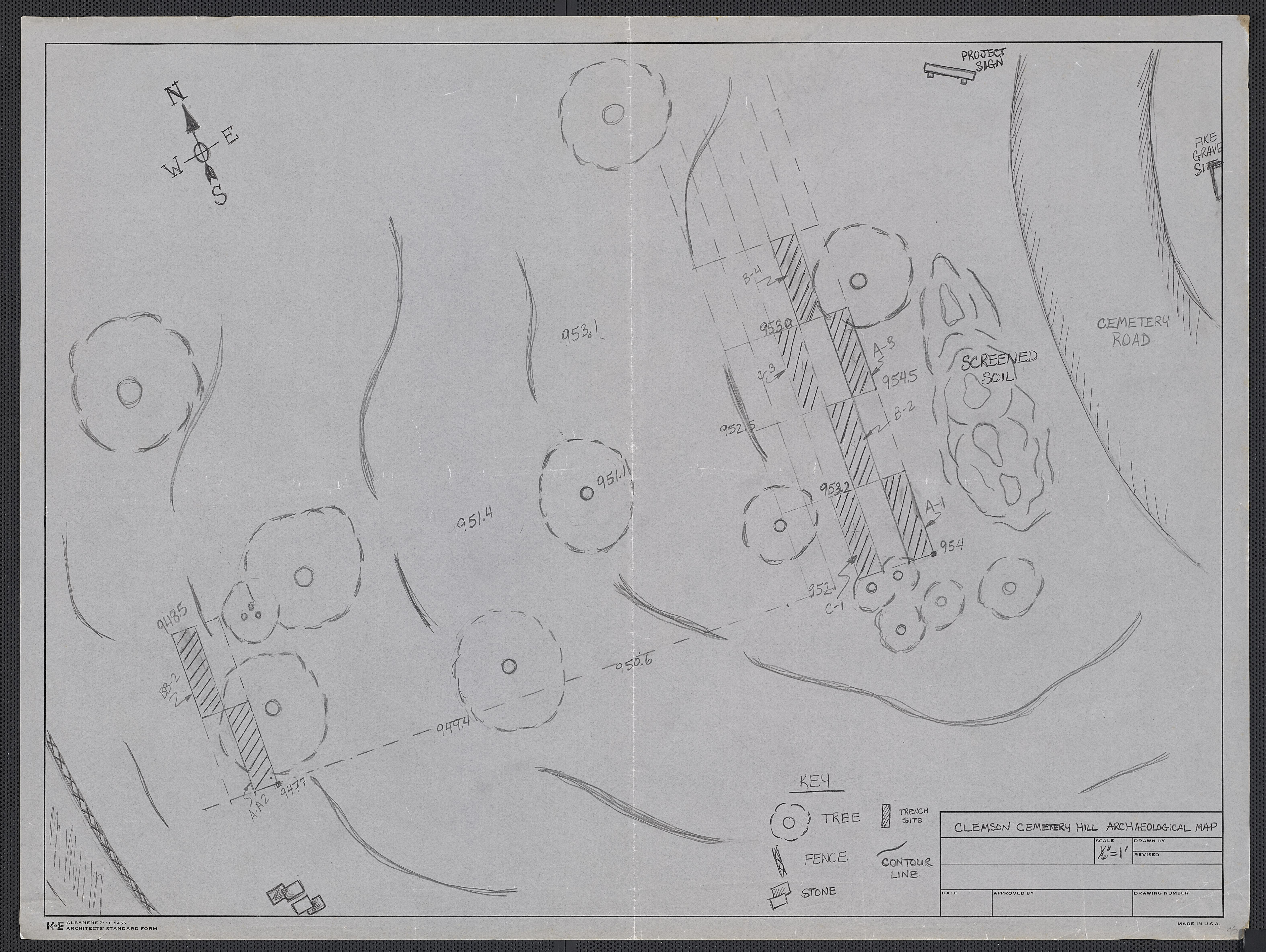
Clemson Cemetery Hill Archaeology Map, 1991, Mss 366, Oversize Folder 2, Papers of Carrel Cowan-Ricks, Special Collections and Archives, Clemson University Libraries.
Cowan-Ricks began her work at the cemetery by producing a site survey map and measuring out an area 100-feet west of the Calhoun family plot as the location of the dig.1 She then established a checkerboard grid of 6 test pits oriented north to south. This design would increase the opportunity of encountering burial shafts of graves, which were oriented east to west. Cowan-Ricks and her students and volunteers mapped their progress, noting roots, rocks, and anomalies they encountered, and bagging and tagging each artifact found. The team uncovered two Indigenous projectile points believed to date from the Woodland Period (500 BCE - 1100 CE), bullet casings or cartridges, 20th-century porcelain, and glass bottle tailgating trash, among other artifacts.
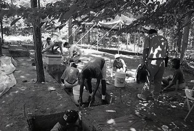
Cowan-Ricks practiced public archaeology. She included Clemson undergraduate students, as well as middle school students from Anderson, in the project. Additionally, she worked with African American high school students through the Clemson Career Workshop, and noted, “it is important for them to interpret their own history."2 Her involvement of African American students not only helped her progress quickly in her research but demonstrates how intentional she was about Black representation in the archaeology project.
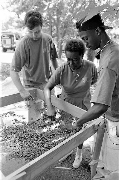
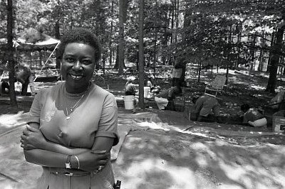
Carrel Cowan-Ricks works with students and volunteers at the Cemetery Hill Archaeological Project in the early 1990s. Series 100, Clemson Historical Photographs, Special Collections and Archives, Clemson University Libraries.
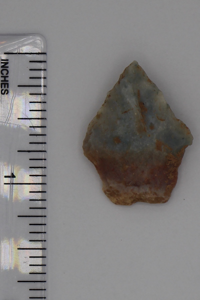
An Indigenous projectile point believed to date from the Woodland Period (500 BCE - 1100 CE) was excavated during the Cemetery Hill Archaeological Project. Box 4, Mss 366, Papers of Carrel Cowan-Ricks, Special Collections and Archives, Clemson University Libraries.
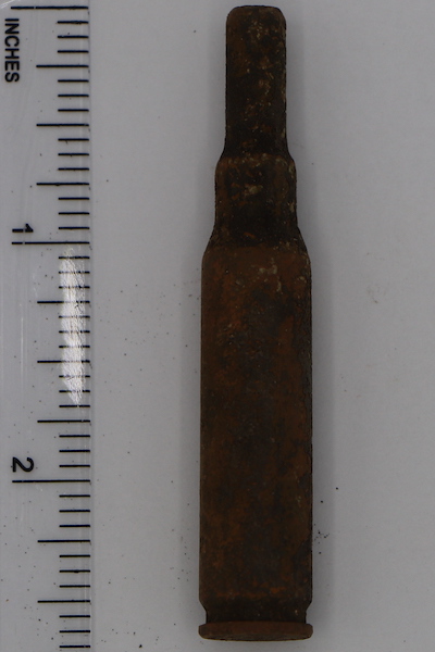
A bullet casing or cartridge, likely the result of a military funeral or Clemson cadet drill practice, was excavated during the Cemetery Hill Archaeological Project. Box 4, Mss 366, Papers of Carrel Cowan-Ricks, Special Collections and Archives, Clemson University Libraries.
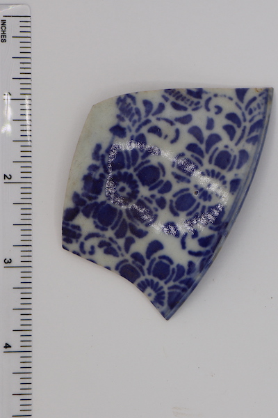
Fragments of porcelain thought to date from the 20th century were excavated during the Cemetery Hill Archaeological Project. Box 4, Mss 366, Papers of Carrel Cowan-Ricks, Special Collections and Archives, Clemson University Libraries.
“We are still in search of the final resting places of those individuals who made significant contributions to the operation of the Calhoun farm and who's labor made the college building plan a reality. This project is dedicated to honoring their memory.”
Carrel Cowan-Ricks"Cemetery Hill Archaeological Project" Article1992
After extensive archival research and community interviews, Cowan-Ricks hypothesized that the African American Burial Ground was not just located on the western side of Cemetery Hill; there were unmarked graves all over the hill. She also wanted to use ground penetrating radar (GPR) and test those survey results against her excavations. At that time, GPR was a relatively new technology for archaeology. Although GPR was not conducted at the cemetery in the 1990s, Cowan-Ricks was an innovative scholar who wanted to use the most state-of-the-art technology to recover this history.
Clemson University let Carrel Cowan-Ricks go in 1993 after budget cuts, even though she was not finished with the Cemetery Hill Archaeological Project and needed more time. She passed away a few years later in 1997 from lupus in Michigan. Her contributions to Clemson University included service and community collaboration. Professor Cowan-Ricks was a strategic thinker, an activist, and a dedicated scholar. Her work at Clemson thirty years ago forms the basis of current research and continues to guide this project. The story of the African American Burial Ground may have been forgotten had it not been for her visionary work and leadership.
Learn more about Carrel Cowan-Ricks
Call My Name and Student Activism
In February 2020, after taking part in a tour designed by the Call My Name project and being encouraged by Dr. Rhondda Thomas to visit the "Fort Hill Slave and Convict Cemetery" on the south hillside of the cemetery, Clemson University students Sarah Adams and Morgan Molosso Crocker went to the site and found it to be littered, unkempt, and neglected. At that time, the site was designated only by a black chain-linked fence that was broken or completely down in places, and the sign on the site stated, "Unknown Burials, circa 1865." The students contacted Dr. Thomas who suggested they talk with the University Historian, as well as Historic Properties, Campus Planning, and Facilities staff to help devise a plan to clean up and preserve the site and install a memorial. Funding for the initiative was provided by the Office of the Provost.
Call My Name Website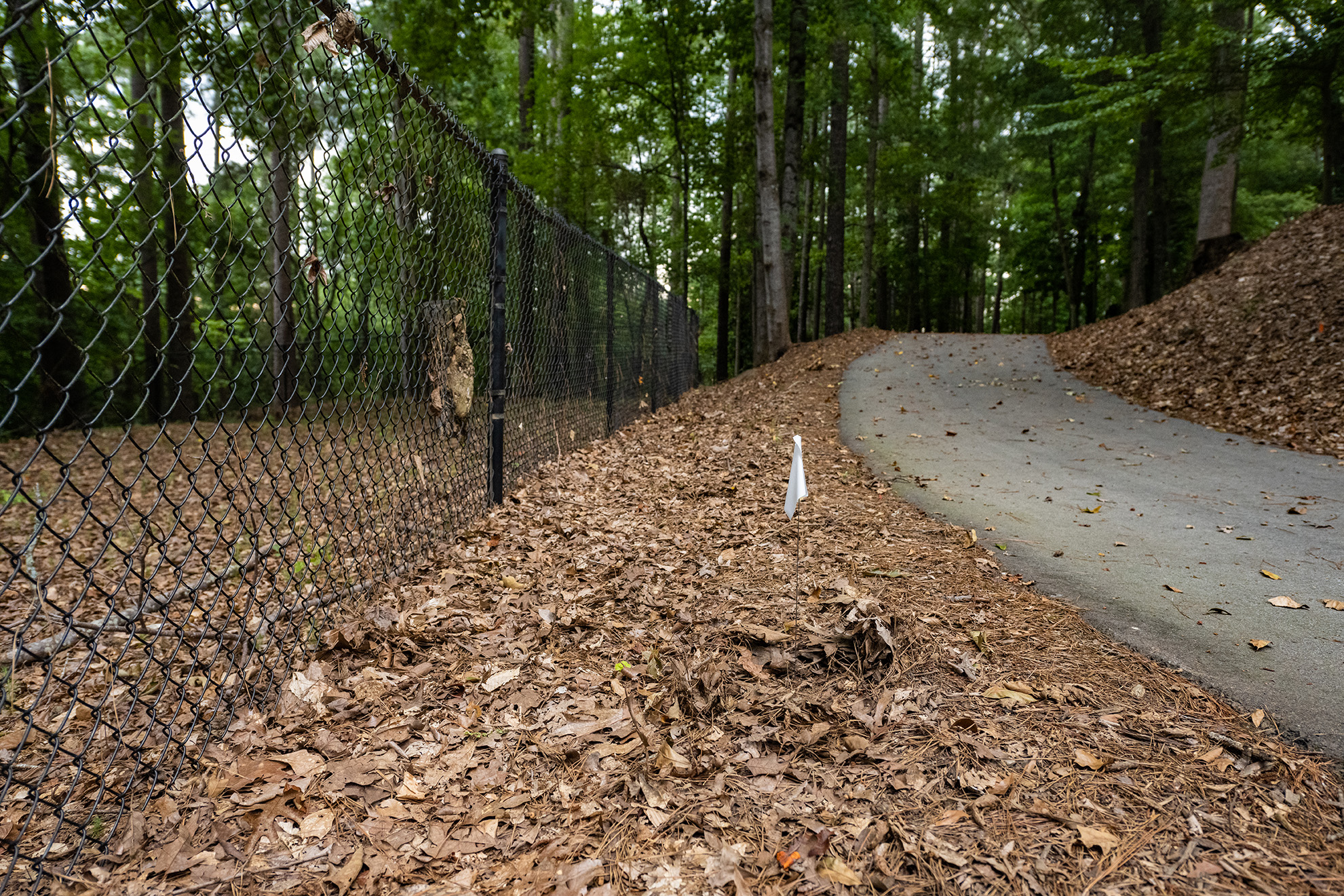
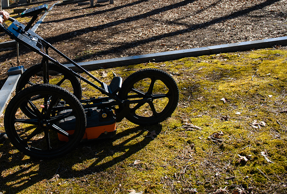
Ground Penetrating Radar
What is GPR?
Ground penetrating radar is a geophysical tool with many applications from utility work to archaeological digs and cemetery burial mapping. A technician walks the GPR unit in a series of winding lines over the area in search of soil anomalies. The unit transmits a radar signal into the ground and an antenna receives the returning signal as it reflects off objects in the ground such as rock, concrete, wood, or, for cemeteries, caskets or variations in soil deposits and density. The reflected signal is interpreted to determine what features are naturally occurring, like tree roots, and which features are artificial disturbances, like burials. Analysis of data is a lengthy process that accounts for all potential variations that the unit received. GPR can detect if coffins are intact or collapsed, or if no coffin was used at all. Any disturbances in the ground, like graves, are typically seen at consistent depths and are consistent in size. Confidence levels for GPR data analysis today are quite high, and it is one of the most comprehensive geophysical tools available to reconstruct burial patterns.4
June and July 2020
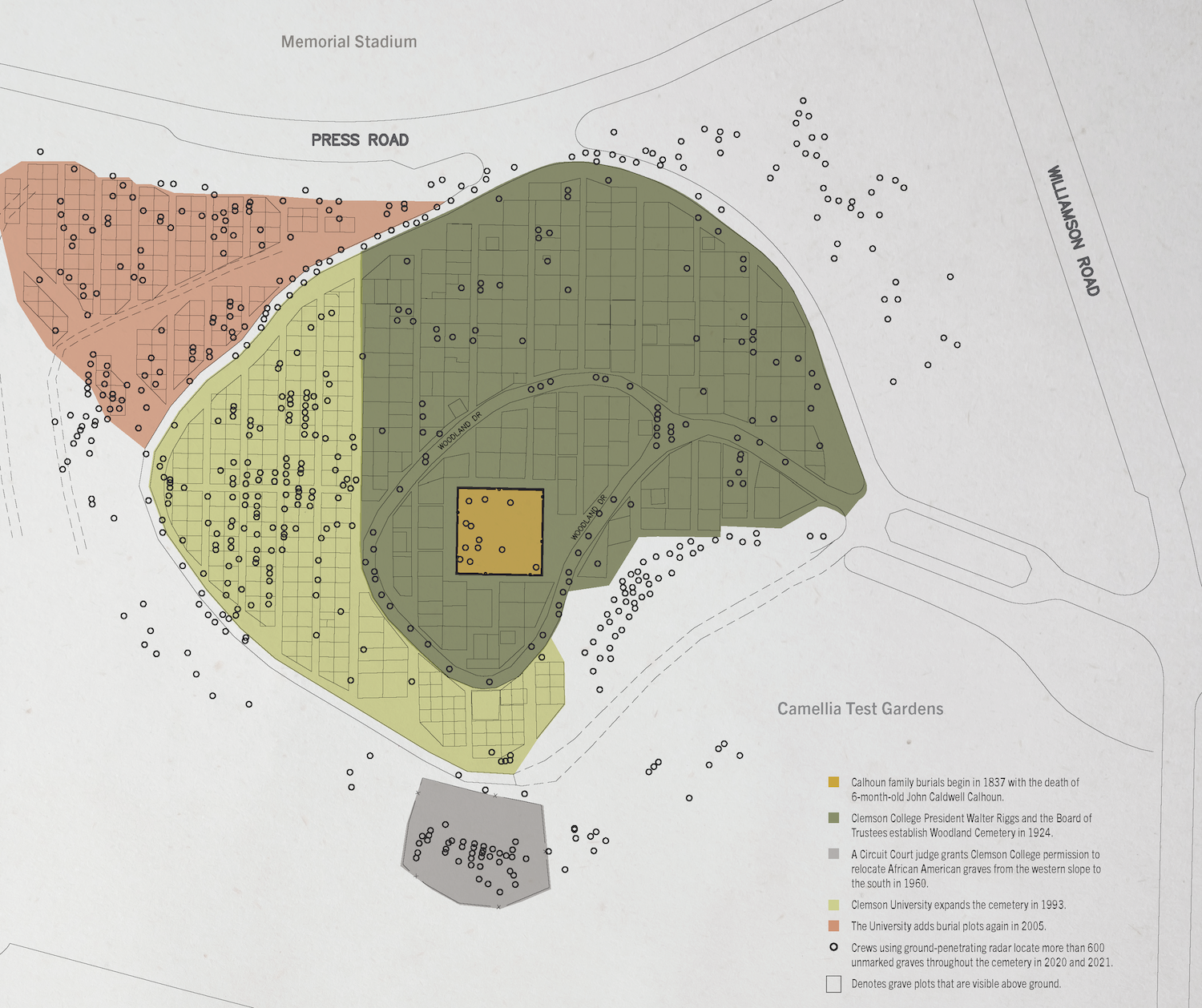
A site team, comprised of members from Preservation South, Summit Engineering, Clemson University Facilities, and Clemson faculty, staff, and alumni, began identifying possible graves within the fenced area that students had asked to be cleaned up and preserved. The team marked field stones with small red flags, because field stones are the traditional markers of historic graves in the South. When doing this, the site team found field stones well outside the fenced area, extending over a range of three acres along the south and west sides of the cemetery. This finding indicated that the burial ground was far larger than currently known or marked and was supported by archival evidence that suggested as many as 250 African Americans were buried on the hill. As a result, the site team proposed ground penetrating radar (GPR) tests at both ends of the three-acre site to determine the burial ground’s boundaries and extent. The initial planned scope of the GPR work is shown in red on the accompanying maps.
Time-Lapse of GPR Work at Woodland Cemetery in 2020. Video created by Trey Sherer, Clemson University.
July 28 and July 29, 2020
The day before the GPR testing was to begin on the south side of the site, archival research in Carrel Cowan-Ricks’s papers revealed a document previously not known to the team: a 1960 Oconee County court order. According to the court order, Clemson University had requested and received legal permission to disinter burial remains of enslaved people and convicted laborers from the west side of the cemetery, directly behind the A. P. Calhoun Family Plot, to the south side, where the team was planning to test the next day.3 With this new information in hand, the team requested partial GPR testing in the western area of the cemetery as described in the court order. That testing revealed the existence of 160 unmarked graves.
August and September 2020
The site team conducted several phases of additional GPR work that resulted in the recovery of more unmarked burials—most of them clustered on the northern, northwestern, and western slopes of the hill. This was the area long understood as the African American Burial Ground. A substantial number were also detected on the southern and southeastern quadrants of the hill. The GPR survey also detected 12 unmarked burials at the crest of the hill, within the fenced area enclosing the gravesites of several members of Andrew Pickens Calhoun’s family. The recovery of 12 unmarked burials at the hill crest raises the possibility that African Americans were buried on the site prior to the Calhoun family’s acquisition of Fort Hill Plantation.
2021
Because of overgrowth in the northeast and southeast of the cemetery, the site team was unable to perform GPR for the entirety of the cemetery until January 2021. GPR work in those two corners of the cemetery detected even more burials, bringing the number of unmarked graves to over 500.
In September 2021, additional archaeological survey work was carried out to ensure all unmarked graves are identified.
Citations
- Clemson Cemetery Hill Archaeology Map, 1991, Mss 366, Box 2, Oversize Folder 2, Papers of Carrel Cowan-Ricks, Special Collections and Archives, Clemson University Libraries.
- Bill Swain, "Students Dig into History," The Messenger 39, no. 44, July 18, 1992, in Mss 366, Box 2, Folder 11, Papers of Carrel Cowan-Ricks, Special Collections and Archives, Clemson University Libraries.
- State of South Carolina, County of Oconee, Court of Common Pleas, Ex parte: The Clemson Agricultural College of South Carolina, In Re: The Purported Cemetery of Unknown Deceased Persons, Petition, 22 August 1960, and Order, 3 September 1960, in Mss 366, Box 2, Folder 17, Papers of Carrel Cowan-Ricks, Special Collections and Archives, Clemson University Libraries.
- Lawrence B. Conyers, Interpreting Ground-Penetrating Radar for Archaeology (London: Routledge, 2016).
